


Barren River Area Development District (Outer) PUMA, Kentucky
About
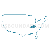
Outline
+PUMA%2c+Kentucky_A280.png)
Summary
| Unique Area Identifier | 192991 |
| Name | Barren River Area Development District (Outer) PUMA |
| State | Kentucky |
| Area (square miles) | 3,425.93 |
| Land Area (square miles) | 3,378.29 |
| Water Area (square miles) | 47.64 |
| % of Land Area | 98.61 |
| % of Water Area | 1.39 |
| Latitude of the Internal Point | 36.83570700 |
| Longtitude of the Internal Point | -85.84992700 |
Maps
+PUMA in Kentucky.png)
Graphs
Select a template below for downloading or customizing gragh for Barren River Area Development District (Outer) PUMA, Kentucky
+PUMA%2c+Kentucky_T0.png)
+PUMA%2c+Kentucky_T1.png)
+PUMA%2c+Kentucky_T2.png)
+PUMA%2c+Kentucky_T3.png)
+PUMA%2c+Kentucky_T4.png)
+PUMA%2c+Kentucky_T5.png)
+PUMA%2c+Kentucky_T6.png)
+PUMA%2c+Kentucky_T7.png)
+PUMA%2c+Kentucky.png)
Neighbors
Neighoring Public Use Microdata Area (by Name) Neighboring Public Use Microdata Area on the Map
- Barren River Area Development District (Central)--Warren County PUMA, KY
- Green River Area Development District (Southwest) PUMA, KY
- Lake Cumberland Area Development District (West) PUMA, KY
- Lincoln Trail Area Development District (East) PUMA, KY
- Lincoln Trail Area Development District (West) PUMA, KY
- Pennyrile Area Development District (North) PUMA, KY
- Pennyrile Area Development District (South) PUMA, KY
- Putnam, Overton, Jackson, Clay & Pickett Counties PUMA, TN
- Robertson, Dickson, Cheatham & Hickman Counties PUMA, TN
- Sumner County--Hendersonville City PUMA, TN
- Warren, Macon, Smith, DeKalb, Cannon & Trousdale Counties PUMA, TN
Top 10 Neighboring County (by Population) Neighboring County on the Map
- Sumner County, TN (160,645)
- Warren County, KY (113,792)
- Hardin County, KY (105,543)
- Robertson County, TN (66,283)
- Barren County, KY (42,173)
- Muhlenberg County, KY (31,499)
- Logan County, KY (26,835)
- Grayson County, KY (25,746)
- Ohio County, KY (23,842)
- Macon County, TN (22,248)
Top 10 Neighboring County Subdivision (by Population) Neighboring County Subdivision on the Map
- Glasgow CCD, Barren County, KY (21,423)
- Franklin CCD, Simpson County, KY (15,462)
- District 2, Sumner County, TN (15,449)
- Russellville CCD, Logan County, KY (14,754)
- Leitchfield CCD, Grayson County, KY (13,527)
- District 1, Sumner County, TN (12,031)
- Scottsville CCD, Allen County, KY (9,177)
- Sand Hill-Girkin CCD, Warren County, KY (8,016)
- Beaver Dam CCD, Ohio County, KY (7,087)
- Tompkinsville CCD, Monroe County, KY (6,917)
Top 10 Neighboring Place (by Population) Neighboring Place on the Map
- Glasgow city, KY (14,028)
- Portland city, TN (11,480)
- Franklin city, KY (8,408)
- Russellville city, KY (6,960)
- Scottsville city, KY (4,226)
- Tompkinsville city, KY (2,402)
- Morgantown city, KY (2,394)
- Horse Cave city, KY (2,311)
- Cave City city, KY (2,240)
- Munfordville city, KY (1,615)
Top 10 Neighboring Unified School District (by Population) Neighboring Unified School District on the Map
- Sumner County School District, TN (160,645)
- Warren County School District, KY (87,088)
- Hardin County School District, KY (85,779)
- Robertson County School District, TN (66,283)
- Muhlenberg County School District, KY (31,499)
- Barren County School District, KY (26,750)
- Grayson County School District, KY (25,746)
- Ohio County School District, KY (23,842)
- Macon County School District, TN (22,248)
- Logan County School District, KY (20,760)
Top 10 Neighboring State Legislative District Lower Chamber (by Population) Neighboring State Legislative District Lower Chamber on the Map
- State House District 44, TN (70,843)
- State House District 66, TN (66,283)
- State House District 38, TN (60,599)
- State House District 40, TN (60,137)
- State House District 21, KY (52,240)
- State House District 25, KY (51,532)
- State House District 22, KY (46,341)
- State House District 14, KY (45,708)
- State House District 19, KY (44,553)
- State House District 51, KY (43,168)
Top 10 Neighboring State Legislative District Upper Chamber (by Population) Neighboring State Legislative District Upper Chamber on the Map
- State Senate District 18, TN (222,166)
- State Senate District 17, TN (208,424)
- State Senate District 32, KY (126,482)
- State Senate District 10, KY (120,533)
- State Senate District 5, KY (115,364)
- State Senate District 15, KY (115,239)
- State Senate District 3, KY (113,250)
- State Senate District 9, KY (112,974)
- State Senate District 16, KY (102,847)
- State Senate District 6, KY (102,261)
Top 10 Neighboring 111th Congressional District (by Population) Neighboring 111th Congressional District on the Map
- Congressional District 6, TN (788,754)
- Congressional District 2, KY (760,032)
- Congressional District 1, KY (686,989)
Top 10 Neighboring Census Tract (by Population) Neighboring Census Tract on the Map
- Census Tract 16, Hardin County, KY (9,402)
- Census Tract 117, Warren County, KY (8,016)
- Census Tract 9205, Ohio County, KY (7,087)
- Census Tract 115, Warren County, KY (6,605)
- Census Tract 9204, Edmonson County, KY (6,288)
- Census Tract 9704, Simpson County, KY (6,091)
- Census Tract 118, Warren County, KY (6,065)
- Census Tract 802, Robertson County, TN (5,943)
- Census Tract 9506, Barren County, KY (5,937)
- Census Tract 9504, Barren County, KY (5,910)
Top 10 Neighboring 5-Digit ZIP Code Tabulation Area (by Population) Neighboring 5-Digit ZIP Code Tabulation Area on the Map
- 42101, KY (55,648)
- 42141, KY (30,349)
- 42104, KY (29,610)
- 37172, TN (28,714)
- 37148, TN (22,320)
- 42103, KY (18,936)
- 42134, KY (16,785)
- 42164, KY (16,277)
- 42728, KY (15,925)
- 42754, KY (15,349)